
Anúncios
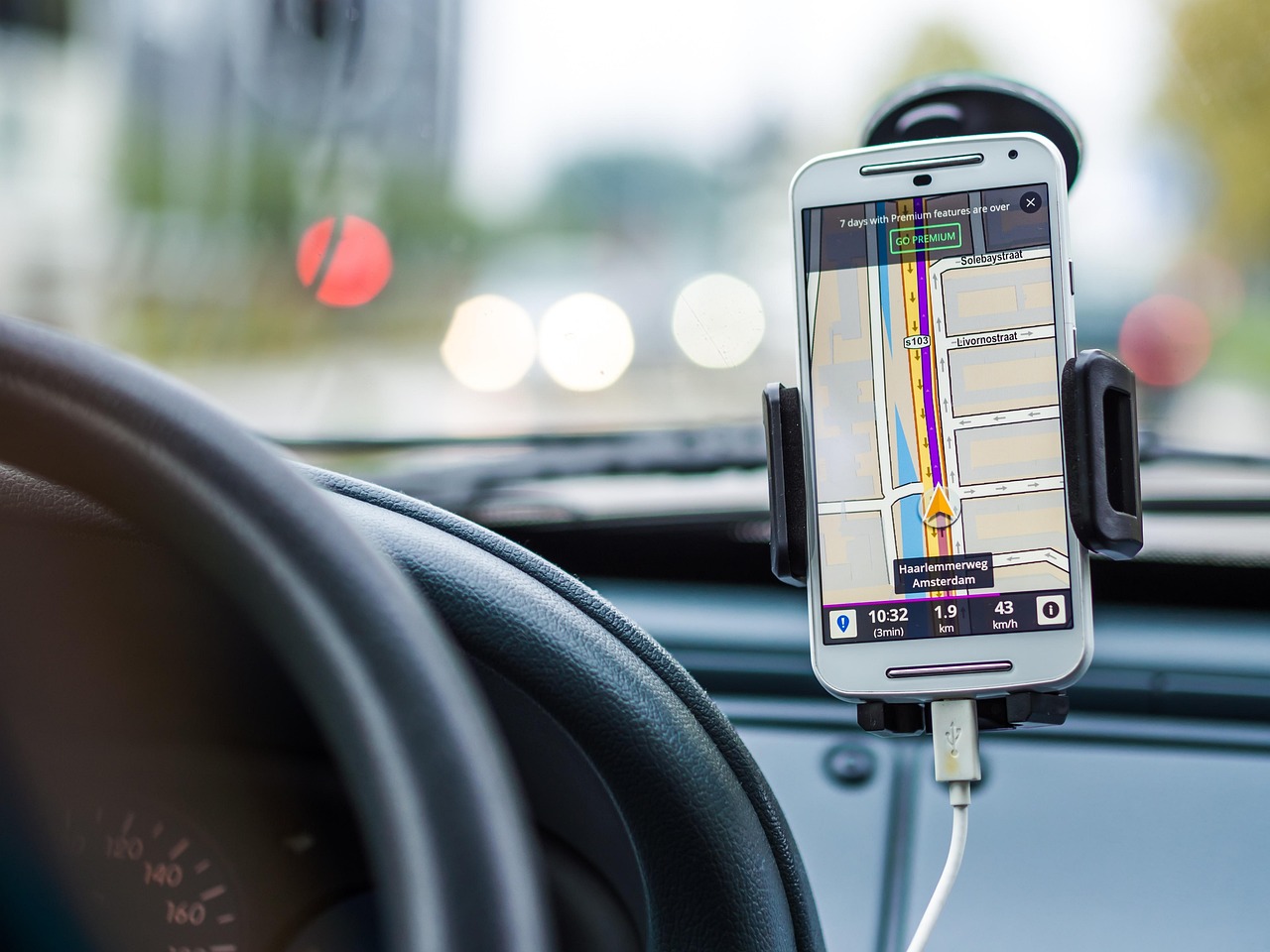
GPS applications have transformed how we navigate the modern world, offering real-time directions, traffic updates, and location-based services right at our fingertips.
Anúncios
Whether you’re exploring a new city, commuting to work, or embarking on a road trip adventure, GPS apps have become indispensable tools for millions of users worldwide. These sophisticated applications combine satellite technology with smart algorithms to deliver accurate positioning and intelligent routing suggestions.
The evolution of GPS technology has been remarkable, transitioning from bulky standalone devices to sleek smartphone applications that offer far more than simple directions. Today’s GPS apps provide comprehensive features including voice-guided navigation, offline maps, points of interest, and community-driven traffic reports that help users avoid delays and find the fastest routes.
📱 Understanding How GPS Applications Work
Anúncios
GPS applications rely on a network of satellites orbiting Earth to pinpoint your exact location. Your smartphone receives signals from multiple satellites simultaneously, calculating distance based on the time it takes for signals to arrive. This triangulation process determines your precise coordinates within meters.
Modern GPS apps enhance this basic satellite positioning with additional data sources. They integrate cellular tower information, Wi-Fi networks, and accelerometer data to improve accuracy, especially in urban environments where tall buildings can interfere with satellite signals. This multi-source approach ensures consistent performance across various environments.
The magic happens when location data combines with mapping databases. GPS applications access vast repositories of road information, business listings, and user-generated content to create dynamic, interactive maps. These databases receive constant updates, reflecting new roads, closed businesses, and changing traffic patterns.


🗺️ Popular GPS Applications and Their Unique Features
The GPS application market offers diverse options, each with distinctive strengths. Google Maps dominates with comprehensive coverage spanning nearly every corner of the globe. Its integration with Google’s ecosystem provides seamless access to business information, reviews, photos, and opening hours. The app excels at public transportation directions, offering detailed schedules and route options across multiple transit systems.
Waze stands out through its community-driven approach. Millions of users contribute real-time information about traffic conditions, accidents, police presence, and road hazards. This crowdsourced intelligence creates an ever-updating traffic picture that helps drivers navigate around congestion. The app’s social features include the ability to share your estimated arrival time with friends and family.
Apple Maps has made significant strides since its rocky launch, now offering detailed city experiences with 3D landmarks, immersive walking directions with augmented reality features, and privacy-focused design that minimizes location tracking. The app integrates beautifully with iOS devices and other Apple services.
🚗 Specialized Navigation Apps for Different Needs

Beyond mainstream options, specialized GPS applications cater to specific use cases. HERE WeGo provides excellent offline functionality, allowing travelers to download entire country maps for navigation without internet connectivity. This proves invaluable for international travelers avoiding expensive roaming charges.
Sygic GPS Navigation appeals to users seeking advanced features like head-up display projection, dashcam functionality, and detailed lane guidance. The app offers premium features at competitive prices compared to standalone GPS devices.
For outdoor enthusiasts, apps like AllTrails and Komoot focus on hiking, cycling, and off-road navigation. These applications provide topographic maps, elevation profiles, trail difficulty ratings, and user reviews specific to recreational activities beyond driving.
🌟 Key Features That Define Quality GPS Applications
Several core features distinguish exceptional GPS applications from mediocre ones. Real-time traffic information ranks among the most valuable, helping users avoid congestion and save significant commute time. Advanced apps analyze historical traffic patterns alongside current conditions to predict future delays and suggest optimal departure times.
Voice navigation has evolved substantially, with natural-sounding instructions that clearly communicate upcoming maneuvers. The best applications provide context-aware guidance, announcing street names, landmarks, and distance measurements in ways that match how humans naturally give directions.
Offline capability addresses a critical need for users in areas with poor connectivity or those traveling internationally. Quality GPS apps allow downloading map regions for complete functionality without internet access, including turn-by-turn navigation and point-of-interest searches.
🔍 Search and Discovery Capabilities
Powerful search functions separate great GPS applications from good ones. Users should easily find destinations using various query types—addresses, business names, categories, or natural language descriptions. Intelligent autocomplete speeds up searches by predicting destinations based on location, time of day, and search history.
Point-of-interest databases enhance the navigation experience by providing detailed information about restaurants, gas stations, hotels, attractions, and services along your route. Integration with review platforms helps users make informed decisions about where to stop.
Some applications offer exploration features that suggest interesting places nearby, curated collections of attractions, and personalized recommendations based on preferences and past behavior. These discovery tools transform GPS apps from simple navigation utilities into comprehensive travel companions.
⚡ Maximizing Battery Life While Using GPS Apps
GPS applications are notoriously power-hungry, but several strategies minimize battery drain. Reducing screen brightness significantly extends usage time since the display consumes substantial power. Many GPS apps include night mode themes that further reduce energy consumption during evening navigation.
Downloading offline maps eliminates the need for constant data connectivity, which saves battery power. Cellular and Wi-Fi radios consume considerable energy when continuously transmitting and receiving data. Offline navigation relies primarily on GPS reception and local processing.
Closing unnecessary background applications prevents resource competition. When multiple apps run simultaneously, the processor works harder and drains the battery faster. Dedicating device resources to navigation ensures optimal performance and efficiency.
Consider using a car charger during long trips to maintain battery levels. Modern smartphones support fast charging, quickly replenishing power even during active navigation. External battery packs provide portable charging solutions for pedestrian navigation or situations without vehicle power access.
🔐 Privacy Considerations with Location-Based Apps
GPS applications necessarily access sensitive location data, raising important privacy considerations. Users should understand what information apps collect, how companies use this data, and what controls exist to limit sharing.
Location history features create detailed records of everywhere you’ve been, which can provide useful personal insights but also represents significant privacy exposure if accessed by unauthorized parties. Most GPS apps allow disabling location history or periodically deleting accumulated data.
Third-party data sharing represents another privacy dimension. Some navigation apps share anonymized location data with advertisers, traffic analysis companies, or other partners. Reading privacy policies reveals these practices, and premium app versions sometimes eliminate advertising-related data collection.
🛡️ Protecting Your Privacy While Navigating
Several practical steps enhance privacy when using GPS applications. Review and adjust location permissions, granting access only when actively using the app rather than allowing constant background tracking. Both iOS and Android operating systems provide granular control over these settings.
Use private browsing or incognito modes offered by some navigation apps when searching for sensitive destinations. These modes prevent searches and routes from appearing in your history or influencing future recommendations.
Consider using navigation apps with stronger privacy commitments. Some applications minimize data collection, avoid personalized advertising, and provide transparent information about their privacy practices. Supporting these privacy-focused alternatives encourages the broader industry to prioritize user privacy.
🚀 Advanced GPS Application Features for Power Users
Power users can leverage advanced GPS features to enhance their navigation experience. Multi-stop route planning allows adding multiple destinations, with the app optimizing the sequence to minimize travel time and distance. This proves particularly valuable for delivery drivers, sales professionals, or anyone running multiple errands.
Custom route preferences enable tailoring navigation to personal priorities. Users can avoid highways, toll roads, ferries, or specific areas entirely. Some applications remember these preferences, automatically applying them to all future routes.
Speed limit warnings and alerts help maintain legal compliance and avoid costly tickets. Advanced GPS apps display current speed limits and provide audible warnings when exceeding them. Some include safety camera locations, though legal regulations regarding these features vary by jurisdiction.
📊 Tracking and Analytics Features
Many GPS applications offer tracking capabilities that record trip details including distance traveled, time spent, routes taken, and average speeds. These analytics benefit business travelers tracking mileage for expense reimbursement, fitness enthusiasts monitoring cycling or running routes, or anyone interested in their movement patterns.
Fleet management versions of consumer GPS apps provide businesses with tools to monitor vehicle locations, optimize routing, and improve operational efficiency. These professional features include dispatching capabilities, driver behavior analysis, and comprehensive reporting.
Integration with other applications expands functionality significantly. GPS apps can share location data with calendar applications for automatic travel time estimates, connect with smart home systems to trigger arrival-based automations, or sync with fitness trackers to log outdoor activities.
🌍 International Travel with GPS Applications
GPS applications shine during international travel, providing navigation assistance in unfamiliar environments without language barriers. Downloading regional maps before departure ensures functionality without expensive international data plans or unreliable foreign network coverage.
Many GPS apps automatically adjust to local conventions, displaying distances in kilometers or miles based on your current location. Language settings allow viewing map labels and receiving navigation instructions in your preferred language, even when traveling abroad.
Public transportation integration proves especially valuable in foreign cities. Comprehensive transit directions help tourists navigate complex subway systems, bus networks, and train schedules without local knowledge. Some applications include ticket purchasing capabilities directly within the app.
💡 Tips for Getting the Most from Your GPS App
Regularly updating your GPS application ensures access to the latest features, improved algorithms, and current map data. Developers continuously refine routing logic, enhance user interfaces, and add new capabilities through updates.
Contribute to community-driven apps by reporting issues, confirming suggested edits, and sharing real-time conditions. Your input improves the experience for all users while making the app more valuable for your own future navigation needs.
Explore settings and customization options to tailor the application to your preferences. Voice selection, map color schemes, alert types, and route preferences can all be adjusted to create a personalized navigation experience that feels intuitive and comfortable.
Practice using offline features before depending on them in critical situations. Download maps, test navigation without connectivity, and familiarize yourself with the app’s offline capabilities to ensure confidence when internet access is unavailable.
🎯 Choosing the Right GPS Application for Your Needs
Selecting the ideal GPS application depends on individual requirements and usage patterns. Frequent drivers prioritize real-time traffic information and community alerts, making apps like Waze particularly suitable. Those valuing privacy might prefer Apple Maps or other applications with minimal data collection.
International travelers benefit from apps offering robust offline functionality and comprehensive global coverage. Outdoor enthusiasts need specialized applications with topographic maps and trail-specific features that mainstream navigation apps lack.
Consider trying multiple applications to determine which interface, feature set, and routing algorithms work best for you. Most GPS apps are free, making experimentation risk-free. Personal preferences regarding voice quality, visual design, and interaction patterns significantly influence user satisfaction.
The ecosystem integration also matters. iPhone users might find Apple Maps more convenient due to Siri integration and Apple Watch compatibility, while Android users benefit from Google Maps’ tight integration with Google services and Android Auto.
🔮 The Future of GPS Navigation Technology
GPS applications continue evolving with emerging technologies promising exciting enhancements. Augmented reality navigation overlays directional arrows and information onto live camera views, making complex intersections and unfamiliar areas easier to navigate. This technology particularly benefits pedestrians navigating dense urban environments.
Artificial intelligence increasingly powers route optimization, learning individual preferences and predicting destinations based on patterns. Smart suggestions anticipate where you’re going based on time, day, and context without requiring explicit destination entry.
Electric vehicle integration represents a growing focus, with GPS apps calculating routes considering charging station locations, vehicle range, and elevation changes that affect battery consumption. These specialized routing algorithms help EV drivers confidently plan longer journeys.
Autonomous vehicle development relies heavily on GPS technology combined with other sensors. As self-driving cars become more common, navigation applications will evolve from directing human drivers to coordinating with vehicle automation systems.
🌈 Embracing Navigation Technology in Daily Life
GPS applications have become essential tools that simplify modern life in countless ways. They reduce stress by providing reliable directions, save time through traffic avoidance, and enable exploration by making unfamiliar places accessible. The convenience of having a knowledgeable navigator constantly available transforms how we move through the world.
Beyond simple navigation, these applications connect us to vast information networks, help us discover new experiences, and provide safety through location sharing features. They represent remarkable achievements combining satellite technology, sophisticated software, global mapping efforts, and community collaboration.
As GPS technology continues advancing, applications will become even more intelligent, anticipating needs before we articulate them, seamlessly integrating with our connected devices, and providing increasingly personalized experiences. The future of navigation promises innovations we can barely imagine today, built upon the foundation of current GPS applications that already seem indispensable.
Whether commuting to work, exploring new destinations, or simply finding the nearest coffee shop, GPS applications empower us with unprecedented mobility and confidence. Choosing the right app, understanding its features, and leveraging its capabilities transforms these digital tools from simple utilities into invaluable travel companions that enhance every journey.