
Anúncios
Earthquakes can strike without warning, and being prepared with the right tools can make all the difference when it comes to safety and awareness.
Anúncios
Earthquake apps have emerged as essential companions for anyone living in seismically active regions or traveling to areas prone to tectonic activity. These digital tools provide real-time alerts, historical data, and educational resources that empower users to respond quickly and intelligently during seismic events.
From casual users wanting to stay informed to researchers tracking global seismic patterns, earthquake applications offer a range of features designed to enhance preparedness and understanding. Let’s explore everything you need to know about these powerful mobile companions and how they can keep you one step ahead when the ground starts to shake. 🌍
Why Earthquake Apps Matter in Today’s Connected World
Anúncios
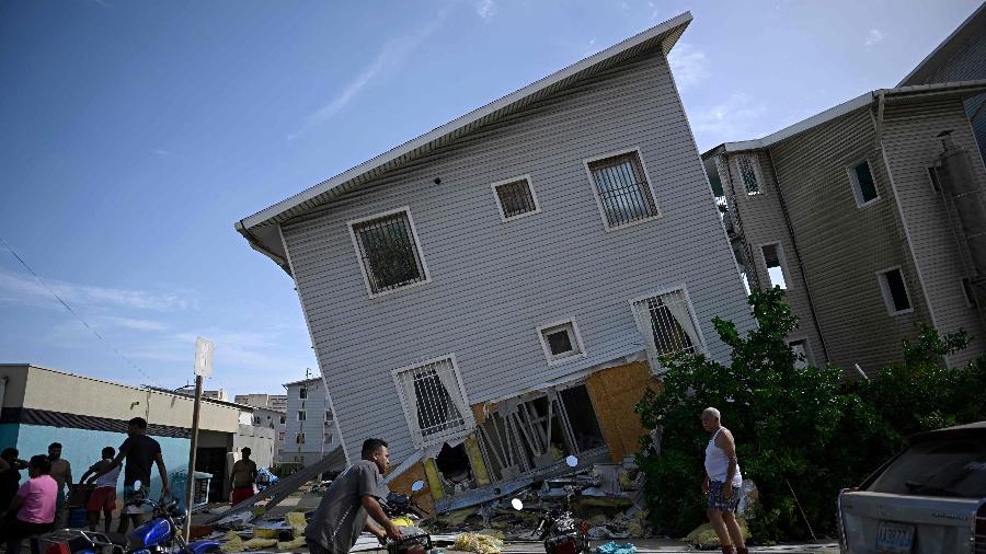
The unpredictability of earthquakes makes them one of nature’s most challenging phenomena to prepare for. Unlike hurricanes or storms that develop over time with forecasting opportunities, earthquakes occur suddenly, often with devastating consequences. This is where technology bridges a critical gap in disaster preparedness.


Modern earthquake applications leverage data from seismological networks worldwide, including the United States Geological Survey (USGS), European-Mediterranean Seismological Centre (EMSC), and national geological services. They transform complex seismic data into accessible, actionable information that anyone can understand at a glance.
The value of these apps extends beyond immediate earthquake detection. They serve educational purposes, help users identify safe zones, provide survival tips, and even contribute to citizen science initiatives. For regions where traditional warning systems may be limited, smartphone apps democratize access to critical safety information.
Key Features That Define Quality Earthquake Applications 📱
Not all earthquake apps are created equal. The most effective solutions share several characteristics that distinguish them from basic information feeds. Understanding these features helps users select the right application for their specific needs and geographic location.
Real-Time Earthquake Notifications and Alerts
The cornerstone of any earthquake app is its notification system. Quality applications deliver alerts within seconds of seismic activity detection, providing users with precious moments to take protective action. These notifications typically include magnitude, depth, epicenter location, and estimated distance from the user’s position.
Advanced apps allow customization of alert parameters—users can set thresholds for magnitude levels, geographic radius, and depth to filter notifications according to personal relevance. This prevents alert fatigue while ensuring critical events never go unnoticed.
Interactive Maps and Visualization Tools
Visual representation of seismic data transforms numbers into comprehensible patterns. The best earthquake apps feature interactive maps displaying recent tremors, tectonic plate boundaries, fault lines, and historical earthquake locations. Users can zoom, filter by time period, and explore details about individual events with simple taps.
Heat maps showing earthquake concentration areas help travelers and residents assess risk levels for specific regions. Three-dimensional visualizations can illustrate earthquake depth and propagation patterns, offering insights that text descriptions alone cannot convey.
Historical Data and Statistical Analysis
Access to comprehensive earthquake archives enables users to understand patterns in their region. Quality applications maintain databases extending decades into the past, allowing analysis of frequency, typical magnitudes, and seasonal variations if applicable.
Statistical dashboards present this information through graphs, charts, and summary statistics. This historical perspective helps communities understand their seismic reality and plan accordingly, whether for personal preparedness or infrastructure development.
How Earthquake Detection Technology Actually Works 🔬
Understanding the technology behind earthquake apps enhances appreciation for their capabilities and limitations. The process begins with seismometers—sensitive instruments detecting ground motion—distributed across networks worldwide. When seismic waves pass through these stations, they generate data that sophisticated algorithms analyze in real time.
Modern systems use P-wave detection as an early warning mechanism. Primary waves (P-waves) travel faster than the destructive secondary waves (S-waves) and surface waves. By detecting P-waves first, systems can issue warnings seconds to minutes before stronger shaking arrives, depending on distance from the epicenter.
Earthquake apps connect to these monitoring networks through APIs and data feeds, receiving processed information almost instantaneously. Cloud computing infrastructure ensures rapid dissemination to millions of users simultaneously, making widespread alerts feasible even during major events when network traffic surges.

Choosing the Right Earthquake App for Your Needs
The marketplace offers numerous earthquake applications, each with distinct strengths. Selection should be based on geographic location, technical literacy, and specific requirements such as travel, research, or family safety coordination.
For users in highly seismic regions like California, Japan, Chile, or Indonesia, apps with robust local network integration provide the most accurate and timely information. These applications often partner with national geological services for enhanced data quality and faster notifications.
Travelers benefit from apps with global coverage and offline functionality. Some applications allow downloading earthquake data for specific regions, ensuring access even without internet connectivity—crucial in disaster scenarios when networks may be compromised.
Evaluating Data Source Reliability
The foundation of any earthquake app is its data source. Applications drawing from established seismological organizations like USGS, EMSC, or GFZ German Research Centre for Geosciences offer superior reliability compared to those using crowd-sourced or unverified data alone.
Transparency about data sources indicates developer credibility. Quality apps clearly state which networks they monitor and update their sources as new partnerships form. Multi-source applications that cross-reference data from several networks provide the most comprehensive picture of seismic activity.
Educational Value Beyond Emergency Alerts 📚
Earthquake applications serve as portable geology classrooms, offering insights into plate tectonics, seismic waves, and Earth’s dynamic nature. Many feature educational sections explaining Richter and moment magnitude scales, the difference between earthquake types, and the relationship between depth and impact.
Interactive tutorials guide users through proper earthquake response procedures: drop, cover, and hold on techniques; identifying safe spaces in buildings; and post-earthquake safety protocols. This education transforms passive users into informed participants in their own safety.
For students and educators, earthquake apps provide real-world data for classroom discussions about geology, physics, and disaster preparedness. The ability to observe actual seismic events as they occur worldwide brings textbook concepts to vivid life.
Community Features and Crowdsourced Information 👥
Modern earthquake apps increasingly incorporate community elements, allowing users to report felt experiences through standardized intensity scales. This crowdsourced data supplements instrumental measurements, providing valuable information about actual ground shaking effects in populated areas.
The “Did You Feel It?” reporting system popularized by USGS has been integrated into numerous applications. Users answer simple questions about their experience, generating community intensity maps that reveal how earthquakes affected different neighborhoods—information that instruments alone cannot capture.
Social features enable users to check on friends and family in affected areas, share safety status, and coordinate emergency responses. These capabilities transform earthquake apps from information tools into communication platforms during critical moments when traditional channels may be overwhelmed.
Privacy Considerations and Data Security 🔒
Location-based services inherently require sharing sensitive information. Reputable earthquake applications implement robust privacy protections, using location data solely for alert customization without unnecessary tracking or third-party sharing.
Users should review privacy policies carefully, understanding what data is collected, how it’s used, and whether it’s shared with advertisers or other entities. Premium versions of apps often provide enhanced privacy features, including anonymous usage modes that deliver alerts without location tracking.
Battery and data consumption also deserve consideration. Continuous location monitoring and background notifications can drain batteries quickly. Quality apps optimize these processes, offering settings to balance functionality with device resource management.
Integration with Emergency Preparedness Systems
The most effective earthquake apps function as components within broader emergency preparedness ecosystems. They complement official warning systems rather than replacing them, providing redundancy that increases overall reliability.
In regions with advanced earthquake early warning systems like Japan’s J-Alert or Mexico’s SASMEX, apps bridge the gap to mobile devices that might not receive traditional broadcast alerts. They also serve international travelers who wouldn’t otherwise access local warning infrastructure.
Integration with smart home systems represents an emerging frontier. Some applications can trigger automated responses like opening garage doors for quick evacuation, shutting off gas lines, or unlocking electronic door locks to prevent entrapment—potentially life-saving features when seconds matter.
Limitations and Realistic Expectations ⚠️
While earthquake apps are powerful tools, understanding their limitations prevents false security. No system can predict earthquakes before they occur; apps provide detection and rapid notification, not forecasting. The lead time for warnings depends entirely on distance from the epicenter—nearby users may receive alerts with little to no advance notice.
Network dependency creates vulnerabilities. Strong earthquakes can damage communication infrastructure, potentially preventing alert delivery when it’s most needed. This underscores the importance of comprehensive preparedness that doesn’t rely solely on technology.
False alarms and missed detections, though rare, do occur. Seismic networks occasionally generate erroneous data, and algorithms may misinterpret signals. Users should treat apps as one information source within a multi-layered approach to earthquake safety.
The Future of Earthquake Detection Technology 🚀
Artificial intelligence and machine learning are revolutionizing earthquake detection. Next-generation systems can identify precursor signals humans and traditional algorithms might miss, potentially extending warning times and improving accuracy.
Smartphone accelerometer networks represent an exciting development. Millions of devices worldwide contain sensors capable of detecting seismic motion. Research projects like MyShake harness these distributed sensors, creating massive detection networks that complement traditional seismometers and improve coverage in underserved regions.
Augmented reality features are emerging in earthquake apps, overlaying seismic information onto camera views to help users visualize fault lines, historical epicenters, and relative risk levels for their immediate surroundings. These innovations make complex geological concepts accessible to everyone.
Practical Tips for Maximizing Your Earthquake App
Installation is just the beginning. To get maximum value from earthquake applications, users should customize settings thoughtfully. Set magnitude thresholds appropriately—too sensitive creates alert fatigue, while overly restrictive settings might miss significant events.
Enable location services but review battery optimization settings to ensure background notifications function properly. Test alerts periodically to verify the app is working correctly and you understand notification sounds and formats during high-stress situations.
Explore all features beyond basic alerts. Familiarize yourself with historical data, educational content, and emergency response information before you need it urgently. Knowledge acquired during calm moments proves invaluable when earthquakes strike.
Share the app with family members and establish communication protocols. Decide in advance how you’ll use the app to coordinate during emergencies, whether through built-in messaging features or by establishing meeting points based on earthquake intensity and location data.
Global Perspectives on Earthquake Apps 🌏
Earthquake app adoption and features vary significantly across regions based on seismic risk, technological infrastructure, and cultural factors. Japanese applications typically offer the most sophisticated features, reflecting the country’s advanced earthquake preparedness culture and frequent seismic activity.
In developing nations with high seismic risk but limited traditional warning infrastructure, mobile apps fill critical gaps. Organizations like the World Bank and UNESCO support initiatives to expand earthquake app access in vulnerable communities, recognizing their potential to save lives where resources are constrained.
Cultural adaptation matters. Effective apps consider language diversity, literacy levels, and local emergency response protocols. Iconography, color coding, and audio alerts must communicate clearly across cultural contexts to achieve maximum effectiveness.
Making Earthquake Apps Part of Your Safety Strategy
Technology alone doesn’t ensure safety—it must integrate into comprehensive preparedness plans. Use earthquake apps to enhance awareness, but combine them with practical measures like securing heavy furniture, maintaining emergency supplies, and practicing evacuation procedures with household members.
Document important information that apps can’t provide: shut-off locations for utilities, medical conditions of family members, insurance policy numbers, and out-of-area emergency contacts. Store this information both digitally and physically, ensuring access regardless of device functionality.
Participate in community preparedness programs that complement individual app usage. Local emergency management agencies offer training that builds skills technology cannot replace. The most resilient communities blend digital tools with human networks, preparedness knowledge, and collective action.
Empowering Yourself Through Technology and Knowledge
Earthquake apps represent remarkable achievements in making scientific data accessible and actionable for everyday users. They democratize access to information that was once available only to researchers and emergency managers, putting powerful tools for safety and education in everyone’s pocket.
The best approach combines multiple resources: official apps from geological services for authoritative data, feature-rich third-party applications for enhanced functionality, and integration with broader emergency preparedness planning. This layered strategy provides redundancy and comprehensive coverage that single solutions cannot match.
As technology continues evolving, earthquake apps will become even more sophisticated, offering longer warning times, more accurate predictions, and seamless integration with smart infrastructure. Staying informed about these developments and updating applications regularly ensures you benefit from the latest advances in seismic safety technology.
Whether you live on a fault line or occasionally travel to seismically active regions, earthquake apps offer peace of mind through preparedness. They transform abstract geological concepts into practical, life-saving tools that anyone can understand and use effectively. Download a quality earthquake app today, explore its features, and take one more significant step toward protecting yourself and your loved ones from nature’s most unpredictable force. 💪